Maps are our way of navigating and understanding space. One of the first maps the Moravians drew of the Wachovia region was in 1754. From that first map, Christian Gottlieb Reuter, Moravian surveyor and cartographer, drafted updated maps of Bethabara and the Wachovia tract every few years. His maps defined property lines, traced roadways, illustrated structures and their purposes, and recorded natural resources, including tree species, minerals, water sources, and stone.
We offer large format park maps in the Visitor Center.
Check out the links below to view the maps on your mobile device or print at home.
Learn about Bethabara’s wildlife in a fun, kid-friendly way! Bethabara’s Mill Creek Loop is now part of the Kids in Parks’ TRACK Trail program. At the head of our trail, you’ll find brochures designed to help children learn about the natural environment. When you’ve completed the loop, you can go to the Kids in Parks’ website to log your walk. Visit https://www.kidsinparks.com/historic-bethabara-park to learn more.
Download Park Map & Scavenger Hunt
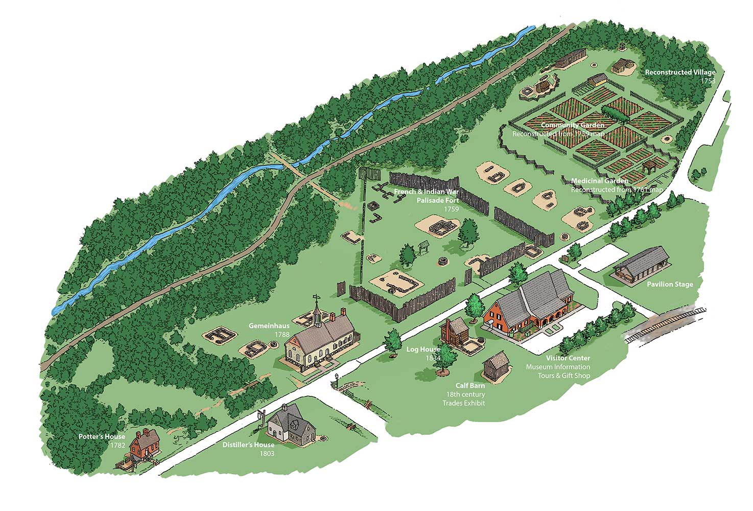
Site Locations
- Visitor Center/Museum, Information, Tours & Gift Shop
- Calf Barn/18th-Century Trades Exhibit
- Log House, ca 1834
- Herman Buttner House, 1803
- Potter’s House, 1782
- Gemeinhaus, 1788
- French and Indian War Fort (reconstructed)
- Community & Medical Gardens (reconstructed)
- 1754 Village (reconstructed)
- Pavilion
- Old Mill Site
- God’s Acre
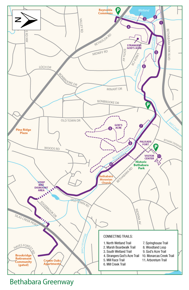
Bethabara Greenway
Park Sites Brochures
Brewer’s House Brochure Gemeinhaus Brochure Potter’s House Medicinal Garden
